
Hiking - Walking
PR6 Between steppe and montado


The "pale" color of Campo Branco (White Field) betrays an impoverished land...
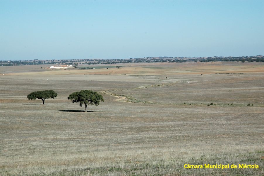
Where old Holm Oak trees resist…

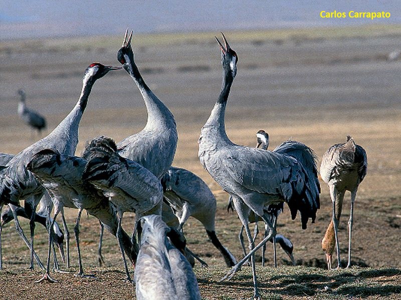
Where Common Cranes feed…
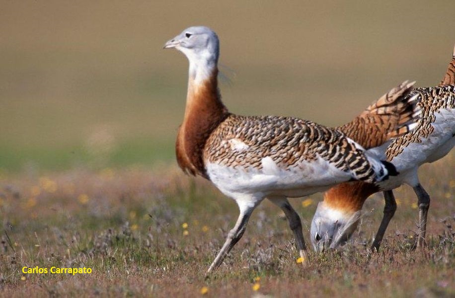
A land rich in steppe birds, like the Great Bustard…
Or the Black-bellied Sandgrouse…

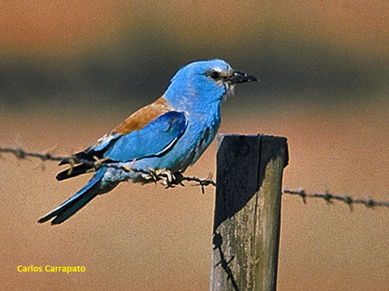
A “White Field” to which birds, like the European Roller, give color!
PR6 Entre a estepe e o montado
Share Image
With Campo Branco (White Field) right next door, this is a land of Great Bustards (Otis tarda) and Common Cranes (Grus grus), with frequent sightings of large flocks while feeding. The route winds through steppe lands and montado of Holm Oak. In between, there are traces of a long abandoned ancient mining.

-
With Campo Branco (White Field) right next door, this is a land of Great Bustards (Otis tarda) and Common Cranes (Grus grus), with frequent sightings of large flocks while feeding. The route winds through steppe lands and montado of Holm Oak. In between, there are traces of a long abandoned ancient mining.
-
Alentejo
-
Mértola
-
Vale do Guadiana Nature Park
Base Characterization
-
PTCON0036 Guadiana
PTZPE0046 Castro Verde
PTZPE0047 Vale do Guadiana (Guadiana Valley)
-
ICNF - Instituto da Conservação da Natureza e das Florestas, I.P.
Route Characterization
-
Access to Mértola, from:
- Beja - IP2, IC27;
- Vila Real de Santo António - IC27;
- Castro Verde - EN123, IC27;
- Lisboa – IP8
Access to Beja, from:
- Spain - N260;
- Lisbon - IP8.
From Mértola take N265direction Beja, turn to Azinhal village (on the left). The trail is marked starting from the National road.
GPS: 37.761156, -7.815497
-
Yes
-
Azinhal
-
Azinhal
-
11 km.
-
All year, but you should avoid Summer.
-
2:30 h
-
50 meters.
-
Easy
-
Ring road
-
Famílias
Supports in place
-
Yes.
-
Coffee shop and public wc in Corte Pequena and Azinhal. Meals and accommodation in Mértola.
Topographic Profile
Take binoculars and a birds guide. Leaflet (in Portuguese) [PDF 933 KB]
Access to Mértola, from:
- Beja - IP2, IC27;
- Vila Real de Santo António - IC27;
- Castro Verde - EN123, IC27;
- Lisboa – IP8
Access to Beja, from:
- Spain - N260;
- Lisbon - IP8.
From Mértola take N265direction Beja, turn to Azinhal village (on the left). The trail is marked starting from the National road.
GPS: 37.761156, -7.815497


