
Hiking - Walking
PR2 Guadiana channels


Miller's house and scale
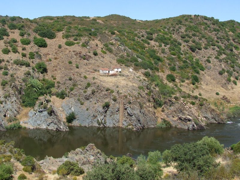
Canais watermill
Canais watermill

Rocha da Galé (Galley's rock)
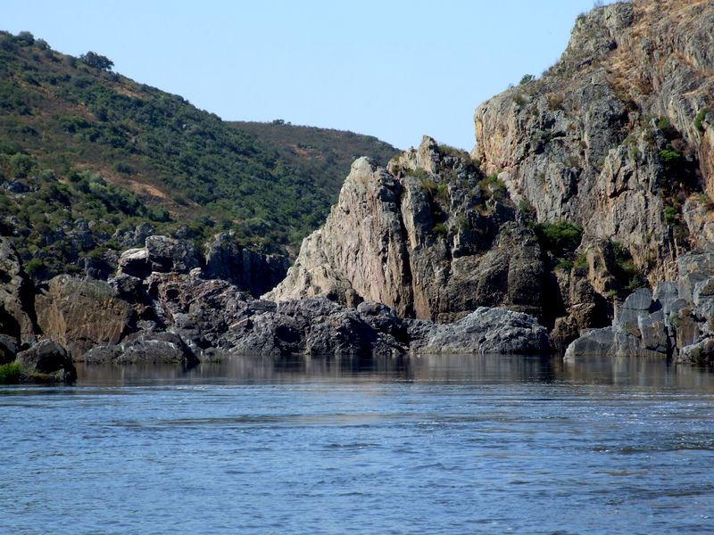
Rocha da Galé (Galley's rock)
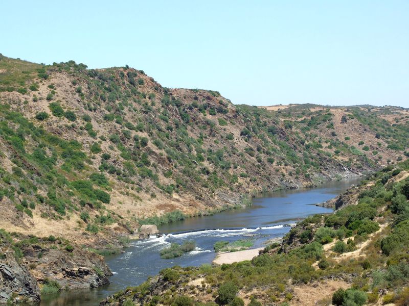
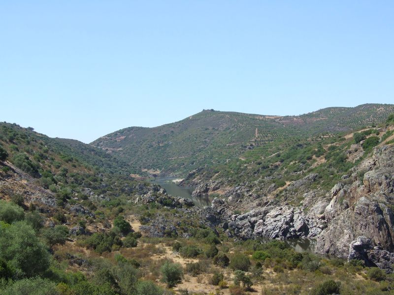
Guadiana's valley
PR2 Canais do Guadiana
Share Image
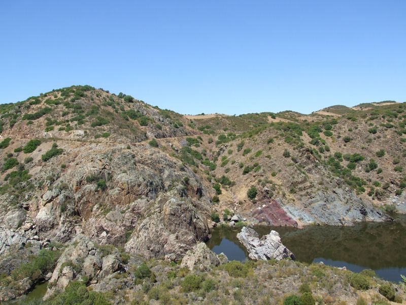
The route begins in the small village of Corte Pequena, with medieval origins, where tranquility and beauty go hand in hand with old people kindness. From there a dirt road leads to Guadiana river. Here, the landscape varies between areas of scrubland and some wheat or barley growing areas. The fence that accompanies the route limits Herdade da Brava (Brava Estate). As you approach the river there is a change in the fauna diversity, appearing tufts of cistus and shrubs such as Montpellier Cistus, Rosemary, French lavender, Cistus crispus, Common Juniper, Sea Squill, Spanish Marjoram and White Asphodel. The area is of particular interest to birdwatching and you can find a huge diversity of species associated with different habitats, such as Bonelli's Eagle, the Eagle Owl or the Black Stork, but not always will be easy to identify the several warblers occurring there. On the steep slopes of the valley note the presence of Holm Oak, Wild Olive and Mastic and, by the river, Flueggea tinctoria. After a turn, in the final part of the route, you can see the tower of what appears to be a water level gauge, used by ancient smugglers to watch the river flow. From this point you can still see emerge from the riverbed an impressive rocky outcrop, known locally as rocha da Galé (Galley Rock). Below, in the last meters of the path, an unexpected "beach" of white gravel and, on the other river bank, the ruins of Moinho dos Canais (Channels water mill), witness the recent history of this place. In days gone by, in this area was used the caneiro (kiddle) - handmade fishing gear - for catching fish. The trap was made of reeds and oleander branches next to the watermill dam that existed there. The mill was dismantled in the 90’s, and today there are only the ruins of the old mill channel and the memory of the nostalgic fishermen. Return by the same route.

-
The route begins in the small village of Corte Pequena, with medieval origins, where tranquility and beauty go hand in hand with old people kindness. From there a dirt road leads to Guadiana river. Here, the landscape varies between areas of scrubland and some wheat or barley growing areas. The fence that accompanies the route limits Herdade da Brava (Brava Estate). As you approach the river there is a change in the fauna diversity, appearing tufts of cistus and shrubs such as Montpellier Cistus, Rosemary, French lavender, Cistus crispus, Common Juniper, Sea Squill, Spanish Marjoram and White Asphodel. The area is of particular interest to birdwatching and you can find a huge diversity of species associated with different habitats, such as Bonelli's Eagle, the Eagle Owl or the Black Stork, but not always will be easy to identify the several warblers occurring there. On the steep slopes of the valley note the presence of Holm Oak, Wild Olive and Mastic and, by the river, Flueggea tinctoria. After a turn, in the final part of the route, you can see the tower of what appears to be a water level gauge, used by ancient smugglers to watch the river flow. From this point you can still see emerge from the riverbed an impressive rocky outcrop, known locally as rocha da Galé (Galley Rock). Below, in the last meters of the path, an unexpected "beach" of white gravel and, on the other river bank, the ruins of Moinho dos Canais (Channels water mill), witness the recent history of this place. In days gone by, in this area was used the caneiro (kiddle) - handmade fishing gear - for catching fish. The trap was made of reeds and oleander branches next to the watermill dam that existed there. The mill was dismantled in the 90’s, and today there are only the ruins of the old mill channel and the memory of the nostalgic fishermen. Return by the same route.
-
Alentejo
-
Mértola
-
Vale do Guadiana Nature Park
Base Characterization
-
PTCON0036 Guadiana
PTZPE0047 Vale do Guadiana (Guadiana Valley)
-
ICNF - Instituto da Conservação da Natureza e das Florestas, I.P.
Route Characterization
-
Access to Mértola from:
- Beja - IP2, IC27;
- Vila Real de Santo António - IC27; or
- Castro Verde - N123, IC27.
Access to Beja, from:
- Spain - N260; and
- Lisbon: IP8.
Corte Pequena village is 15.5 km away from Mértola, on Guadiana left river bank. From Mértola cross the bridge (direction Serpa) and after 4.5 km turn left to Corte de Sines. Take that road until you will found a sign to Corte Pequena, on your left side. From there you have a dirt road, but it is in good conditions.
GPS: 37.682998, -7.644273
-
Yes
-
Corte Pequena
-
Moinho dos Canais
-
1.8 km – 3.6 km (round trip)
-
Spring, Autumn and Winter
-
35 min - 1:10h (round trip).
-
110 meters.
-
Easy
-
Linear
-
Famílias
Supports in place
-
Yes.
Topographic Profile
Learn more
Eatery in Corvos village. Bring water and food with you. Leaflet [PDF 1,4 MB]
Access to Mértola from:
- Beja - IP2, IC27;
- Vila Real de Santo António - IC27; or
- Castro Verde - N123, IC27.
Access to Beja, from:
- Spain - N260; and
- Lisbon: IP8.
Corte Pequena village is 15.5 km away from Mértola, on Guadiana left river bank. From Mértola cross the bridge (direction Serpa) and after 4.5 km turn left to Corte de Sines. Take that road until you will found a sign to Corte Pequena, on your left side. From there you have a dirt road, but it is in good conditions.
GPS: 37.682998, -7.644273


