
Hiking - Walking
Blue trail


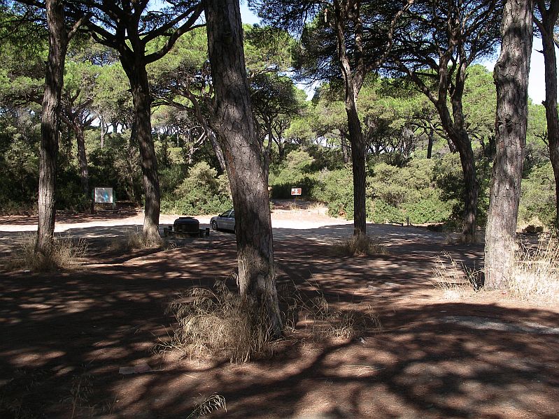
Zimbral picnic area
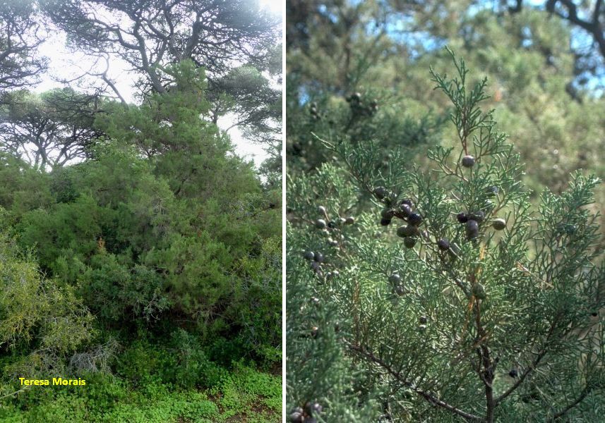
Phoenician Juniper
Firebreaker
Centenar Stone Pine

Viewpoint North
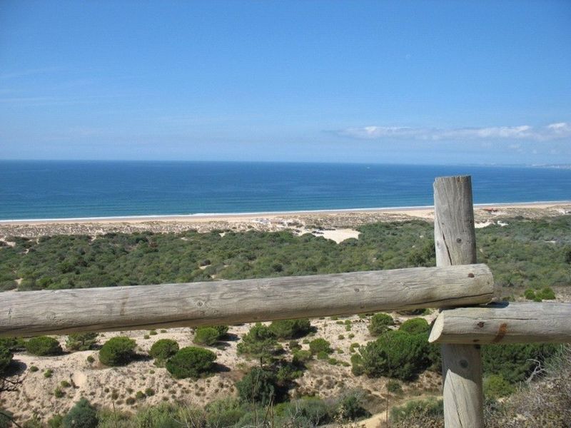
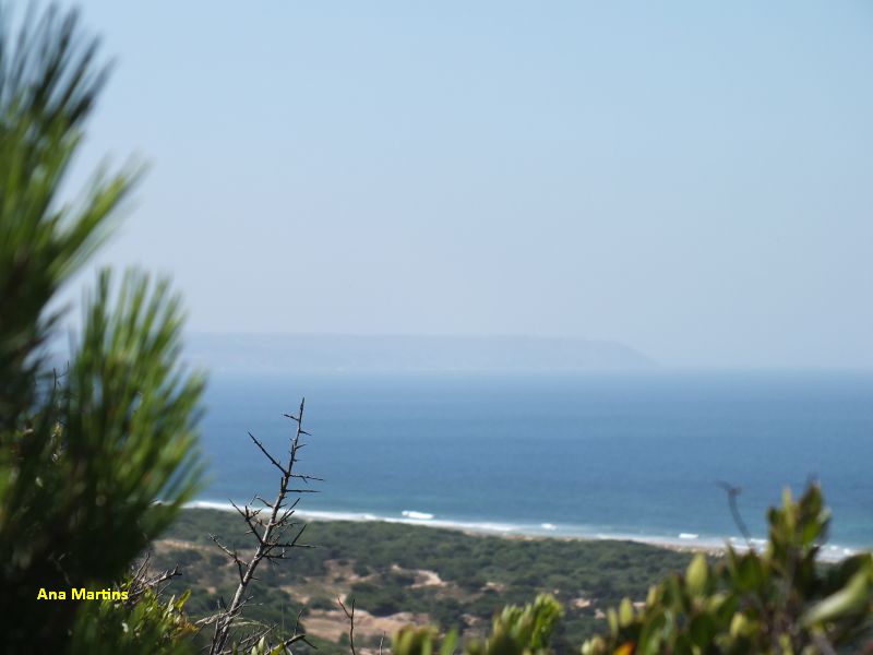
Viewpoint (South) with Espichel cape on the background
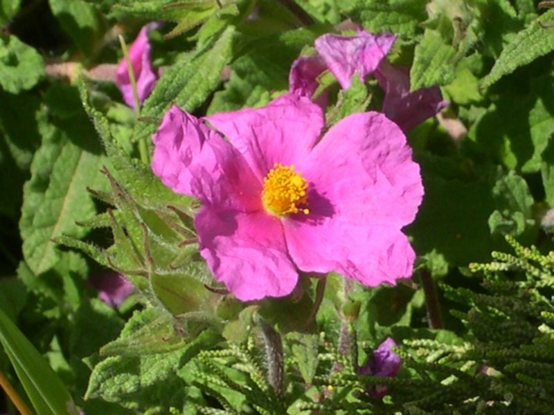
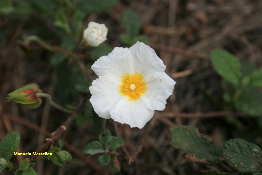
Some of the plants on this trail: Rockrose...
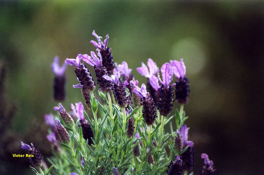
Flowering lavender
Salvia Cistus (flower)
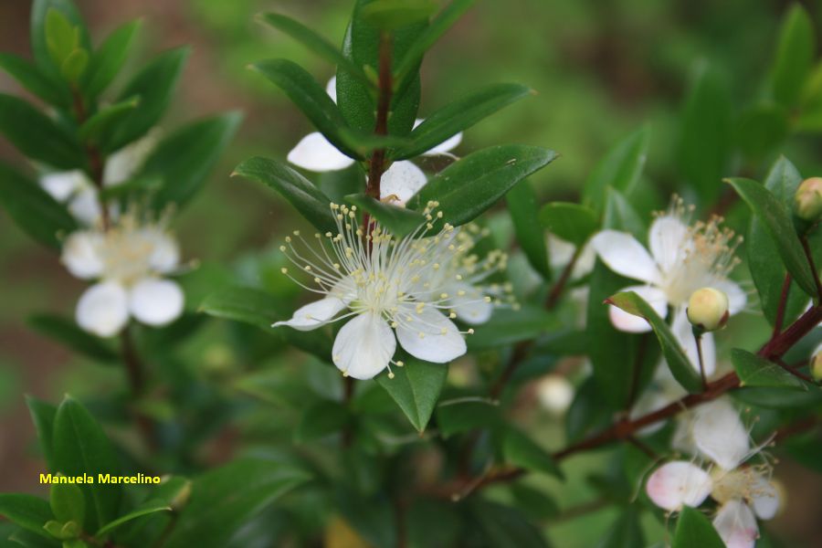
The aromatic myrtle in bloom
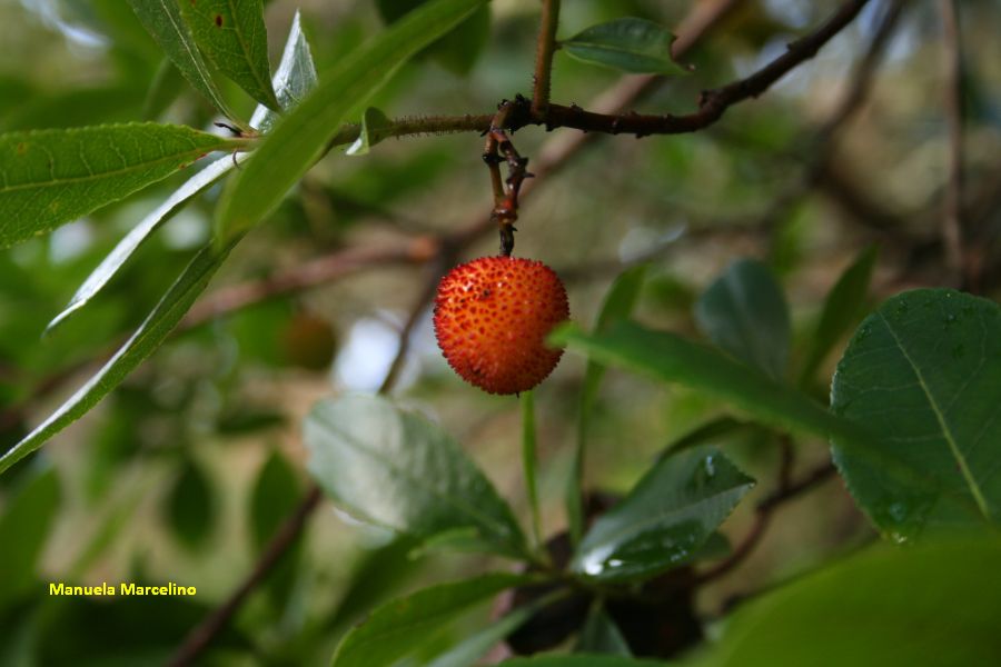
The attractive fruits of the strawberry tree
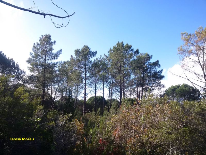
The strong Maritime pines
Small cork oaks among pine trees
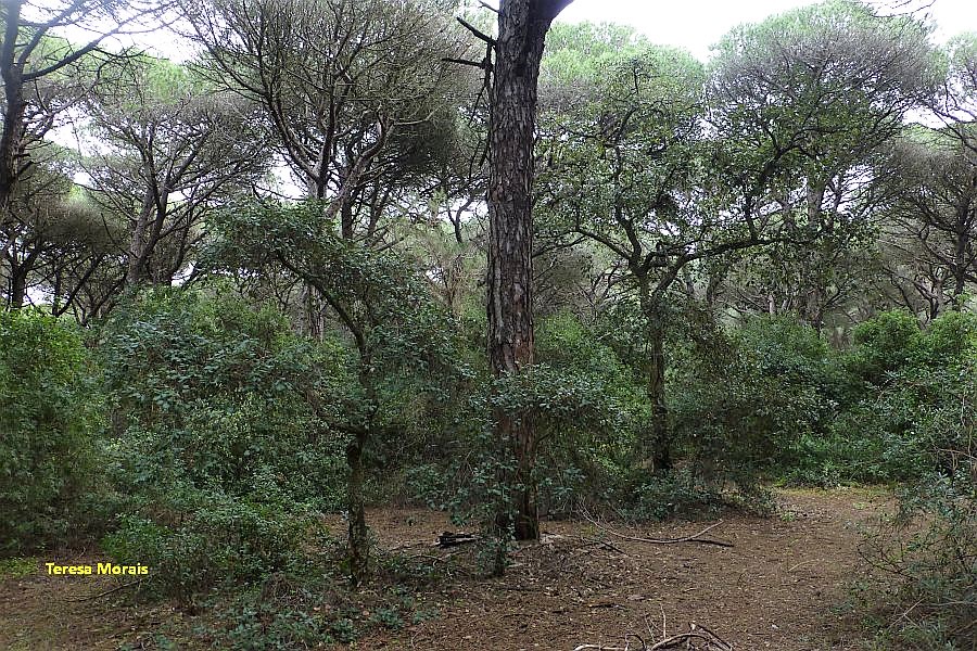
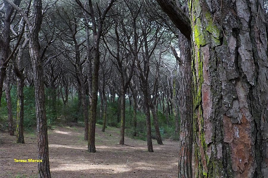
Old part of Medos National Forest
Percurso Azul
Share Image
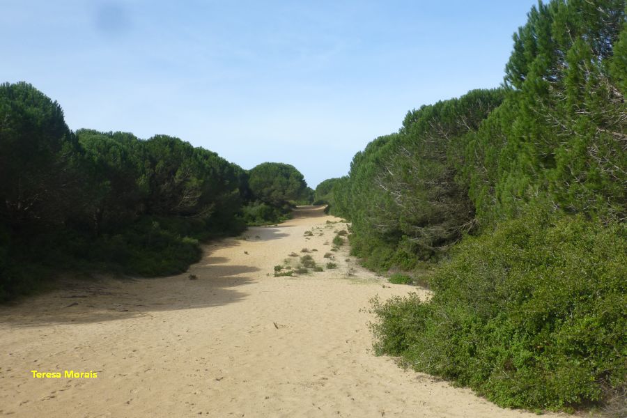
Follow the blue arrows and use shoes suitable for walking in sand. This path allows you to contact with Medos National Forest (“medos” means dunes), in a quiet and calm environment and to observe the dominant plant species, the Stone Pine (Pinus pinea). Under the canopy of pine trees, there are several shrubs, the most important being the Phoenician Juniper (Juniperus turbinata), whose unusual size, together with the centenary Maritime Pines, led to the classification of this forest as a botanical reserve. It was planted during King João V reign to avoid the advance of sand towards the interior agricultural lands. The forest has isolated Maritime Pines (Pinus pinaster) and Aleppo Pines (Pinus halepensis). In terms of shrubs there are also Kermes Oak (Quercus coccifera tolerant to dryness), Mastic Tree (Pistacia lentiscus), Strawberry Tree (Arbutus unedo), Mediterranean Buckthorn (Rhamnus lycioides subsp. oleoides) and aromatic myrtle (Myrtus communis). In a lower stratum appear the Salvia Cistus (Cistus salviifolius), a rockrose (Cistus crispus) and the Butterfly Lavender (Lavandula luisieri). There is a fire-breaker (oriented E-W), a strip without vegetation, to protect forest from fires, that has a viewpoint at the end, where you can see the coast as far as Sintra, as well as Costa de Caparica, the beaches, Dunas woods, with its extensive Jackson wattle an invader acacia from Australia (Acacia saligna). Admire also the fossil cliff, so called, because it is no longer bathed by the sea and don’t function as a cliff. In fact, the epithet "fossil" has to do with this fact and not because it has fossils. Then follow to the 2nd viewpoint from which you can see, to the south, Espichel Cape. In this route is the highest elevation of the fire-breaker, a dune that forms part of the ancient dune system, formed about 2000 years ago due to west winds.

-
Follow the blue arrows and use shoes suitable for walking in sand. This path allows you to contact with Medos National Forest (“medos” means dunes), in a quiet and calm environment and to observe the dominant plant species, the Stone Pine (Pinus pinea). Under the canopy of pine trees, there are several shrubs, the most important being the Phoenician Juniper (Juniperus turbinata), whose unusual size, together with the centenary Maritime Pines, led to the classification of this forest as a botanical reserve. It was planted during King João V reign to avoid the advance of sand towards the interior agricultural lands. The forest has isolated Maritime Pines (Pinus pinaster) and Aleppo Pines (Pinus halepensis). In terms of shrubs there are also Kermes Oak (Quercus coccifera tolerant to dryness), Mastic Tree (Pistacia lentiscus), Strawberry Tree (Arbutus unedo), Mediterranean Buckthorn (Rhamnus lycioides subsp. oleoides) and aromatic myrtle (Myrtus communis). In a lower stratum appear the Salvia Cistus (Cistus salviifolius), a rockrose (Cistus crispus) and the Butterfly Lavender (Lavandula luisieri). There is a fire-breaker (oriented E-W), a strip without vegetation, to protect forest from fires, that has a viewpoint at the end, where you can see the coast as far as Sintra, as well as Costa de Caparica, the beaches, Dunas woods, with its extensive Jackson wattle an invader acacia from Australia (Acacia saligna). Admire also the fossil cliff, so called, because it is no longer bathed by the sea and don’t function as a cliff. In fact, the epithet "fossil" has to do with this fact and not because it has fossils. Then follow to the 2nd viewpoint from which you can see, to the south, Espichel Cape. In this route is the highest elevation of the fire-breaker, a dune that forms part of the ancient dune system, formed about 2000 years ago due to west winds.
-
Lisbon and Tagus Valley
-
Almada
-
Arriba Fóssil da Costa da Caparica Protected Landscape
Base Characterization
-
Medos National Forest
-
Instituto da Conservação da Natureza e das Florestas, I.P.
Route Characterization
-
By car, access from:
- Costa de Caparica (6 km) – follow direction South by Av. Dr. Aresta Branco / N377-2 to Fonte da Telha road.
GPS: 38.601663, -9.196273
-
Yes
-
Zimbral picnic area
-
Zimbral picnic area
-
2.2 km
-
All year long
-
2h
-
24 meters (54 m to 78 m)
-
Easy
-
Ring road
-
Todos os grupos
Supports in place
-
Blue arrows.
-
Picnic area and viewpoints.
Topographic Profile
By car, access from:
- Costa de Caparica (6 km) – follow direction South by Av. Dr. Aresta Branco / N377-2 to Fonte da Telha road.
GPS: 38.601663, -9.196273


