
Hiking - Walking
Socalcos – Relva Velha


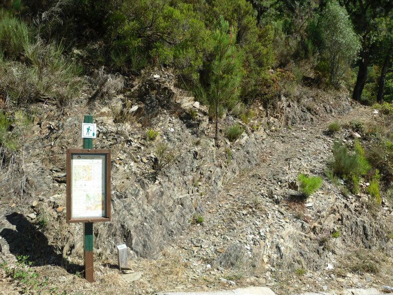
Start the route near Porto Cerejeiro…
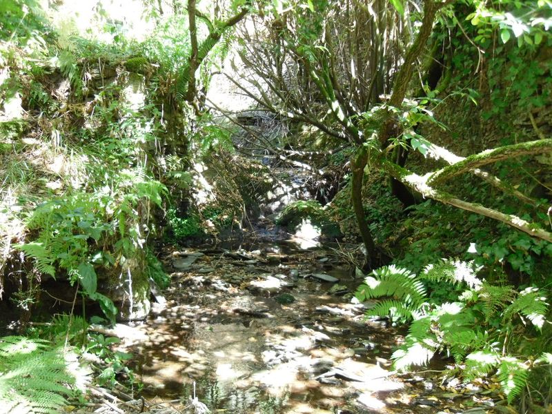
When crossing a watercourse try to observe animals drinking or dragonflies and damselflies laying eggs...
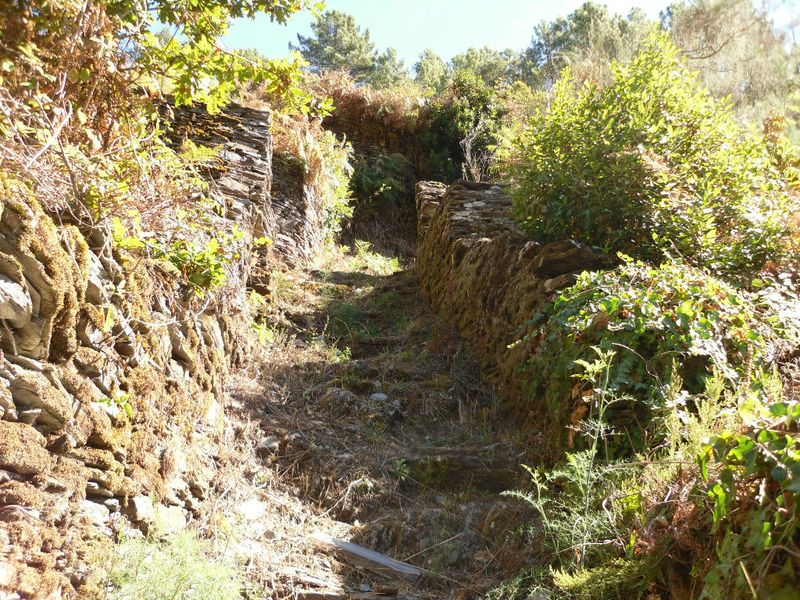
See the “canadas”, paths lined by schist walls used for the cattle move around without access to agricultural land...
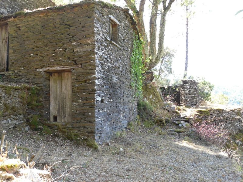
Using regional material, schist, buildings for agriculture support blend with the landscape...
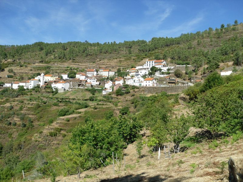
Enjoy the view over the village of Relva Velha (old grass)...
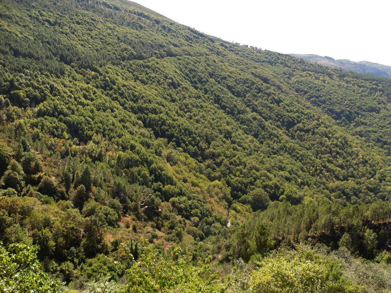
From the village of Relva Velha take a look at the forest of Margaraça, last vestige of the forests that once have covered the mountains from the center of Portugal!
Socalcos – Relva Velha
Share Image
This interpretive circular path with directional signs starts near Mata da Margaraça creek in an area called Porto Cerejeiro and there it crosses the waterline next to an old mill. Its main interesting points are Mata’s creek, the view of Margaraça Forest, the terraces, several traditional agricultural structures and the village of Relva Velha. Much of the route passes through the largest area of agricultural terraces of Serra do Açor Protected Landscape: the village of Relva Velha. Each year, since its construction, was testimony of the work that is developed there by the season’s rhythm. At Açor mountain there are several marks of the people’s struggle for survival. Thus, the terraces or “quelhadas”, on sloping and poor terrain, represent a titanic and persevering effort to win and keep some topsoil. The many “levadas” carried water, crossing the mountains, channeling the precious liquid to villages and “quelhadas” through steep slopes and inaccessible valleys. Along the way there are several interesting elements: terraces supporting walls, “canadas” (lined schist channels walls for the cattle move without access to agricultural land), “cortelhos” to housed cattle and the houses of agricultural support, among others. Almost all the way you can enjoy a privileged view on Margaraça forest enriching this route.

-
This interpretive circular path with directional signs starts near Mata da Margaraça creek in an area called Porto Cerejeiro and there it crosses the waterline next to an old mill. Its main interesting points are Mata’s creek, the view of Margaraça Forest, the terraces, several traditional agricultural structures and the village of Relva Velha. Much of the route passes through the largest area of agricultural terraces of Serra do Açor Protected Landscape: the village of Relva Velha. Each year, since its construction, was testimony of the work that is developed there by the season’s rhythm. At Açor mountain there are several marks of the people’s struggle for survival. Thus, the terraces or “quelhadas”, on sloping and poor terrain, represent a titanic and persevering effort to win and keep some topsoil. The many “levadas” carried water, crossing the mountains, channeling the precious liquid to villages and “quelhadas” through steep slopes and inaccessible valleys. Along the way there are several interesting elements: terraces supporting walls, “canadas” (lined schist channels walls for the cattle move without access to agricultural land), “cortelhos” to housed cattle and the houses of agricultural support, among others. Almost all the way you can enjoy a privileged view on Margaraça forest enriching this route.
-
Center
-
Arganil
-
Serra do Açor Protected Landscape
Base Characterization
-
PTCON0051 Complexo do Açor (Açor Complex)
-
ICNF, I.P.
Route Characterization
-
Access by:
- N17 (estrada da Beira), turn to Coja;
- N334 and turn to Benfeita – Mata da Margaraça.
GPS: 40.216500, -7.910194
-
Yes
-
Near Porto Cerejeiro.
-
Near Porto Cerejeiro.
-
1.7 km
-
All year long
-
2 h
-
145 m (between 602 and 747 m)
-
Hard
-
Ring road
-
Todos os grupos
Supports in place
-
Panel with information at the beginning and directional signs along the way.
Topographic Profile
On the first Sunday of August take part on N. Sra. dos Milagres feast, at Relva Velha.
Access by:
- N17 (estrada da Beira), turn to Coja;
- N334 and turn to Benfeita – Mata da Margaraça.
GPS: 40.216500, -7.910194


