
Hiking - Walking
Pardieiros – Foz da Abelheira


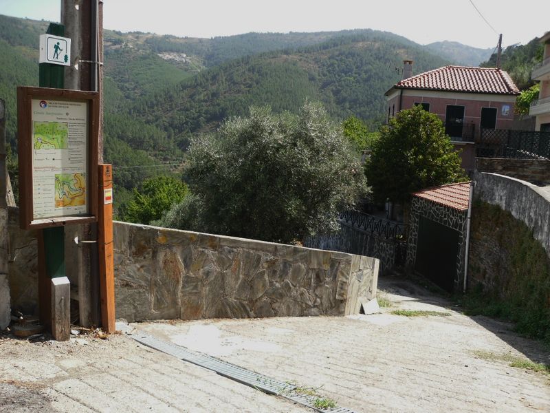
Let's start...
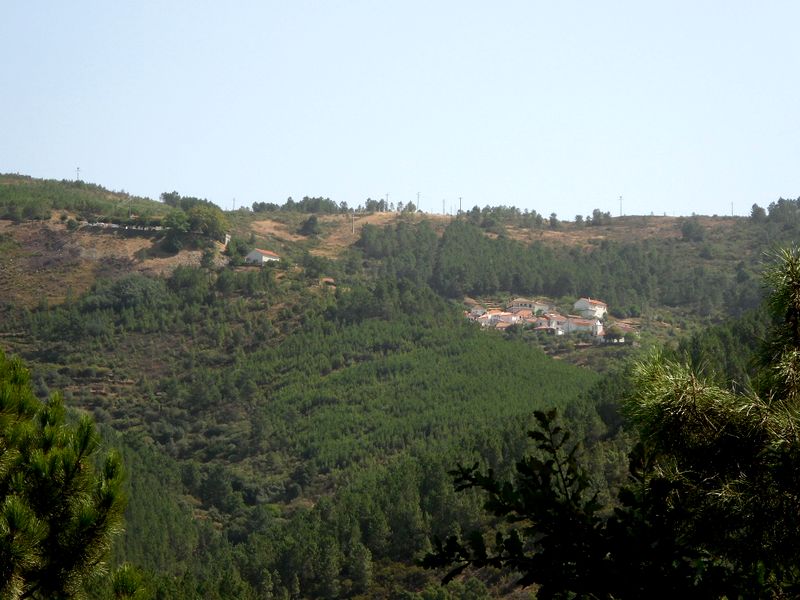
Enjoy the view on Monte Frio…
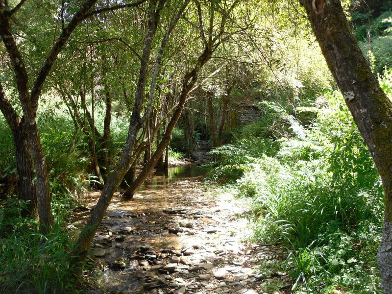
On Mata stream enjoy the freshness and try to find an animal drinking…
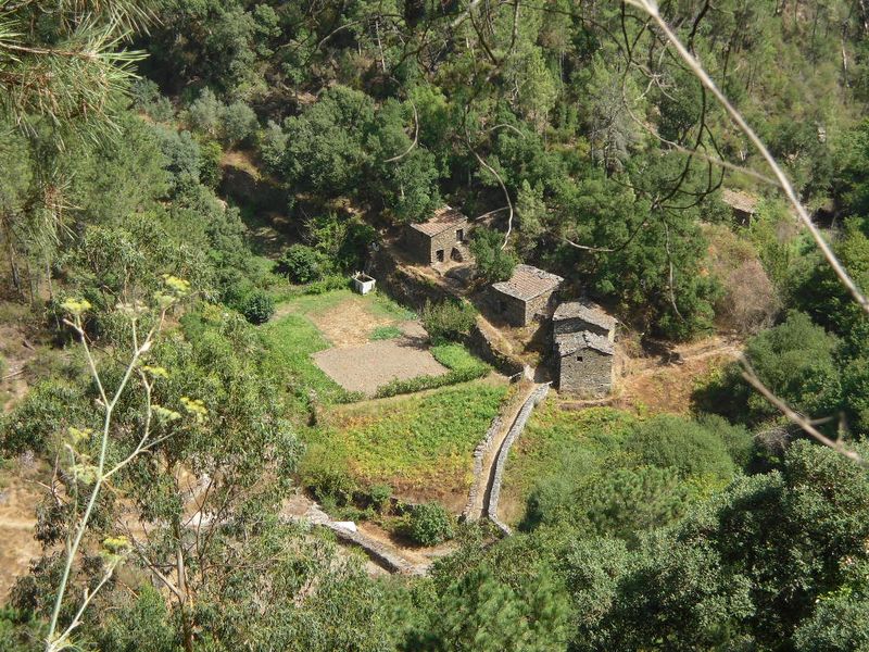
Discover the small farmlands of Foz da Abelheira...
And visit also Pardieiros village.
Pardieiros – Foz da Abelheira
Share Image
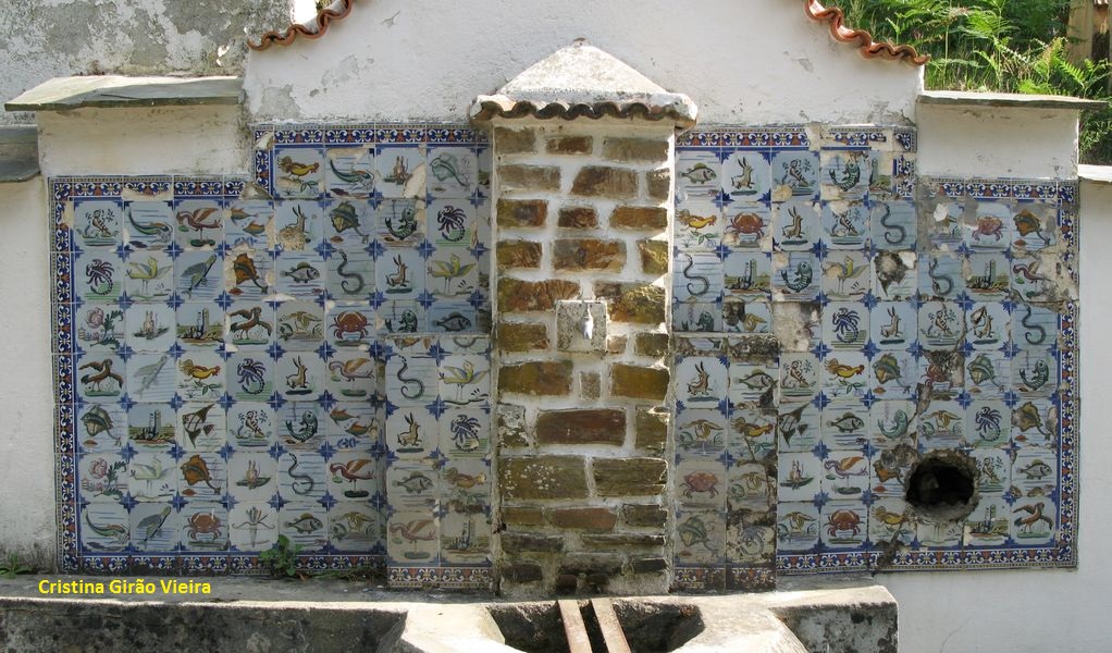
This circular path with directional signs starts at Pardieiros village, so visitors can go through it and enjoy some elements of the rural cultural heritage, such as the streets, some still in shale, old houses in schist, threshing floors, community washtubs... References to this village, the only within Serra do Açor Protected Landscape, in the parish of Benfeita and Arganil municipality, dates back to 1527. Once called Valverde (green valley), the village only took the name Pardieiros (meaning ruined houses) after a typhoid epidemic. The village is known for the manual manufacture of wooden spoons and you still can see artisans carving pieces of pine wood and find out how the spoons are made. In the past, there were here 30- 35 artisans working full time, being this an important economic activity. The manufacture of clogs, bowls and baskets and weaving also existed here but are now extinct. The shale, sloping and poor soil have turned agriculture difficult, so the inhabitants had to made small land portions, known as "quelhadas", with shale walls in order to prevent erosion and allow cultivation. Besides Pardieiros village you can also see Quinta da Foz da Abelheira (a farm), water lines, the artificial bed of these ones and human made agricultural terraces. Foz da Abelheira is one of Pardieiros’ agricultural areas. To get there the route crosses many agricultural terraces. The disposition of these ones, the water lines, windmills and schist houses, the walls, but mostly relief configuration gives some interest to this route. Indeed, as you go down the hill you can enjoy a panoramic view over several valleys that open in front of Pardieiros village in the direction of Monte Frio.

-
This circular path with directional signs starts at Pardieiros village, so visitors can go through it and enjoy some elements of the rural cultural heritage, such as the streets, some still in shale, old houses in schist, threshing floors, community washtubs... References to this village, the only within Serra do Açor Protected Landscape, in the parish of Benfeita and Arganil municipality, dates back to 1527. Once called Valverde (green valley), the village only took the name Pardieiros (meaning ruined houses) after a typhoid epidemic. The village is known for the manual manufacture of wooden spoons and you still can see artisans carving pieces of pine wood and find out how the spoons are made. In the past, there were here 30- 35 artisans working full time, being this an important economic activity. The manufacture of clogs, bowls and baskets and weaving also existed here but are now extinct. The shale, sloping and poor soil have turned agriculture difficult, so the inhabitants had to made small land portions, known as "quelhadas", with shale walls in order to prevent erosion and allow cultivation. Besides Pardieiros village you can also see Quinta da Foz da Abelheira (a farm), water lines, the artificial bed of these ones and human made agricultural terraces. Foz da Abelheira is one of Pardieiros’ agricultural areas. To get there the route crosses many agricultural terraces. The disposition of these ones, the water lines, windmills and schist houses, the walls, but mostly relief configuration gives some interest to this route. Indeed, as you go down the hill you can enjoy a panoramic view over several valleys that open in front of Pardieiros village in the direction of Monte Frio.
-
Center
-
Arganil
-
Serra do Açor Protected Landscape
Base Characterization
-
PTCON0051 Complexo do Açor (Açor Complex)
-
Instituto da Conservação da Natureza e das Florestas, I.P.
Route Characterization
-
Access to Pardieiros, from:
- Coja (± 12 km) - N344 and M518;
- Arganil (± 19 km) - N342, M1345-1, M1347 and M518; or
- Piódão (± 22 km) - M508-1, M508 and N344.
GPS: 40.225173, -7.931139
-
Yes
-
Pardieiros
-
Pardieiros
-
1.5 km
-
All year long
-
1:50h
-
86 m (between 379 m and 495 m)
-
Medium
-
Ring road
-
Todos os grupos
Supports in place
-
Panel with information at the beginning of the path and signs along the way.
Topographic Profile
Before going to Pardieiros, visit the Interpretation Center at Mata da Margaça.
On the last Saturday of August, but starting Thursday, takes place the village feast.
Access to Pardieiros, from:
- Coja (± 12 km) - N344 and M518;
- Arganil (± 19 km) - N342, M1345-1, M1347 and M518; or
- Piódão (± 22 km) - M508-1, M508 and N344.
GPS: 40.225173, -7.931139


