
Hiking - Walking
Quercus


Quercus
Share Image
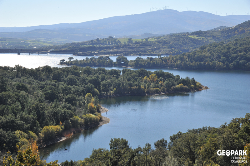
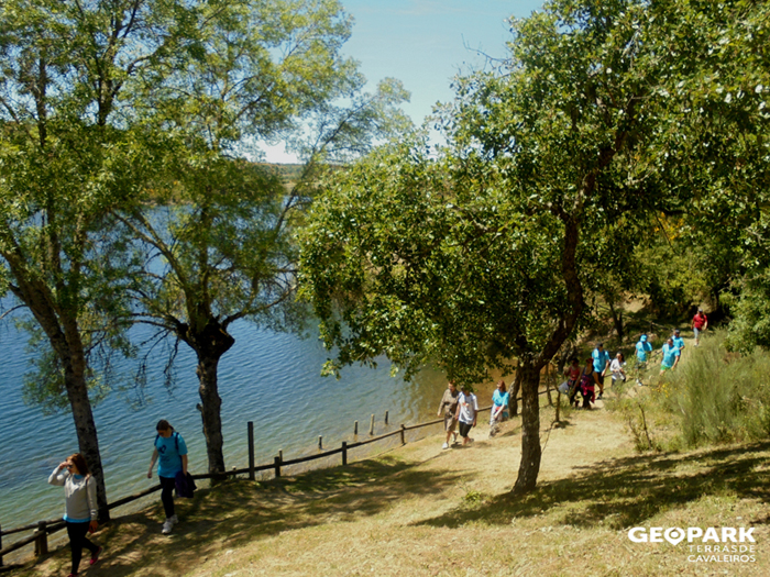
It follows the reservoir left margin, crossing one of the biggest cork oak (Quercus suber) areas in the north-east of Portugal. With high scenic beauty, stands out the set formed by the schist escarpments bordering the place where Azibo River enters the reservoir and by the trunks of partially submerged trees. At the end of the trail, Fraga da Pegada river beach, with a set of facilities, provides a well-deserved rest.

-
It follows the reservoir left margin, crossing one of the biggest cork oak (Quercus suber) areas in the north-east of Portugal. With high scenic beauty, stands out the set formed by the schist escarpments bordering the place where Azibo River enters the reservoir and by the trunks of partially submerged trees. At the end of the trail, Fraga da Pegada river beach, with a set of facilities, provides a well-deserved rest.
-
North
-
Macedo de Cavaleiros
-
Albufeira do Azibo Protected Landscape
Base Characterization
-
PTCON0023 Morais
-
Association Geoparque Terras de Cavaleiros
Route Characterization
-
Access to Macedo de Cavaleiros from:
- Macedo de Cavaleiros - N216;
- Mirandela - A4 exit to N15 and take N15-5;
- Bragança - A4 exit 39 and N15-4
Azibo Eco Park is about 11 km away from Macedo de Cavaleiros.
GPS: 41.558750, -6.883751
-
No
-
Near Azibo Eco Park
-
Car park near Fraga da Pegada river beach
-
8.2 km
-
All year long
-
4 h
-
93 m
-
Medium
-
Linear
-
Todos os grupos
Supports in place
-
Marked and signalled according to national and international standards.
Topographic Profile
Leaflet in Portuguese.
Access to Macedo de Cavaleiros from:
- Macedo de Cavaleiros - N216;
- Mirandela - A4 exit to N15 and take N15-5;
- Bragança - A4 exit 39 and N15-4
Azibo Eco Park is about 11 km away from Macedo de Cavaleiros.
GPS: 41.558750, -6.883751


