
Hiking - Walking
Historical Way: Carrapateira > Vila do Bispo


Caminho Histórico: Carrapateira > Vila do Bispo
Share Image
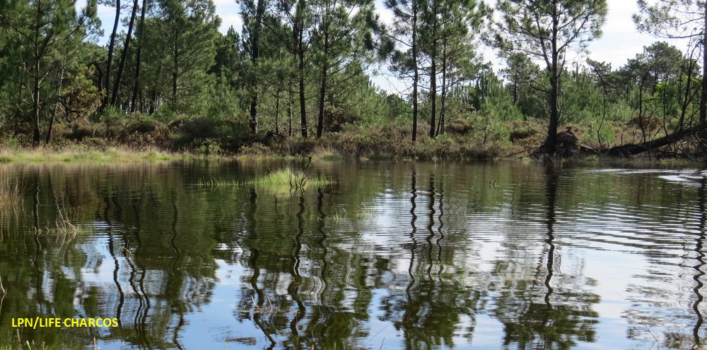
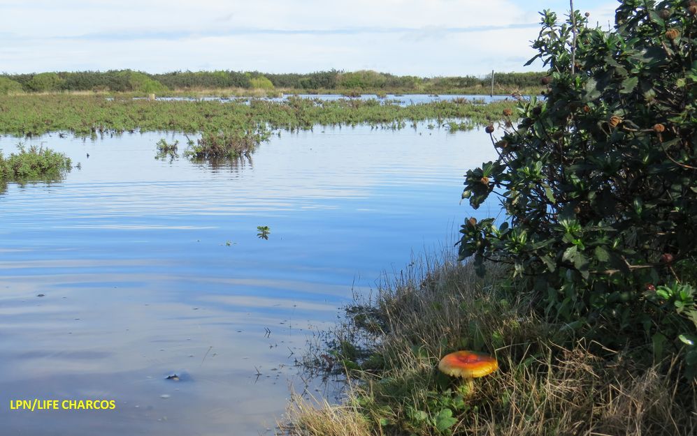
Trail integrated in Rota Vicentina - Grand Route with 230 km that can be travelled in 12 sections, in both directions, ranging between 15 and 25 km. This path runs through valleys, hills and streams (where you can admire the natural vegetation) with great views of the immense sandy beach of Bordeira. The path suggests the passage through the village of Pedralva and the Forest Perimeter of Vila do Bispo. It is still possible to observe the existence of sensitive habitats as the temporary ponds. Path approved by the Federação Portuguesa de Campismo e Montanhismo de Portugal (FCMP) and integrating the GR 11/ E9, which connects Sagres to St. Petersburg. In February 2016, the Historical Way has been certified by the European wide label “Leading Quality Trails – Best of Europe”, a certification from ERA – European Ramblers Association.

-
Trail integrated in Rota Vicentina - Grand Route with 230 km that can be travelled in 12 sections, in both directions, ranging between 15 and 25 km. This path runs through valleys, hills and streams (where you can admire the natural vegetation) with great views of the immense sandy beach of Bordeira. The path suggests the passage through the village of Pedralva and the Forest Perimeter of Vila do Bispo. It is still possible to observe the existence of sensitive habitats as the temporary ponds. Path approved by the Federação Portuguesa de Campismo e Montanhismo de Portugal (FCMP) and integrating the GR 11/ E9, which connects Sagres to St. Petersburg. In February 2016, the Historical Way has been certified by the European wide label “Leading Quality Trails – Best of Europe”, a certification from ERA – European Ramblers Association.
-
Algarve
-
Aljezur
-
Sudoeste Alentejano e Costa Vicentina Nature Park
Base Characterization
-
PTCON0012 Costa Sudoeste (Southwest Coast)
PTZPE0015 Costa Sudoeste (Southwest Coast)
-
Outros Estatutos em Inglês
-
Rota Vicentina Association
Route Characterization
-
Access to Carrapateira,
By car
From Lisbon (263 km): take the A2 motorway to Setúbal. Take the exit at IC33/ A26 to Santiago do Cacém and Sines. In Sines, follow direction Sul-Algarve (N120-1; N393; M502-1; N120). After passing Aljezur (N120, N268), arrive at Carrapateria (20 km) and find the main square.
From Faro (105 km): take the A22 motorway or N125 till Lagos. In Lagos take N120 to Aljezur. Before Aljezur turn left to Mte. Ruivo/ Alfambras (N268), after 10 km is Carrapateira.
Public transports
Plane: nearest airport is Faro International Airport (105 km).
Train: nearest train station is in Lagos (CP).
Bus: Eva Transportes (Aljezur>Carrapateira: monday and friday) and Rede Nacional de Expressos (bus stop in Aljezur).
-
Yes
-
Largo do Comércio (main square)
-
Church
-
22 km
-
All year, but you should avoid Summer.
-
6 h
-
Easy
-
Linear
Supports in place
-
Yes.
-
Infraestruturas de Apoio em Inglês
Topographic Profile
Bring walking shoes, water and binoculars.
Supply only at km 9.5 in Pedralva village.
Know more: http://en.rotavicentina.com/
Access to Carrapateira,
By car
From Lisbon (263 km): take the A2 motorway to Setúbal. Take the exit at IC33/ A26 to Santiago do Cacém and Sines. In Sines, follow direction Sul-Algarve (N120-1; N393; M502-1; N120). After passing Aljezur (N120, N268), arrive at Carrapateria (20 km) and find the main square.
From Faro (105 km): take the A22 motorway or N125 till Lagos. In Lagos take N120 to Aljezur. Before Aljezur turn left to Mte. Ruivo/ Alfambras (N268), after 10 km is Carrapateira.
Public transports
Plane: nearest airport is Faro International Airport (105 km).
Train: nearest train station is in Lagos (CP).
Bus: Eva Transportes (Aljezur>Carrapateira: monday and friday) and Rede Nacional de Expressos (bus stop in Aljezur).


