
Hiking - Walking
Boca do Rio Biodiversity Station


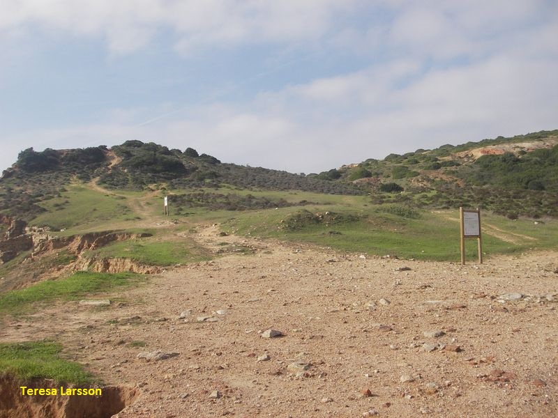
Start your walk at the base of the cliff...
Read the information on the panels...
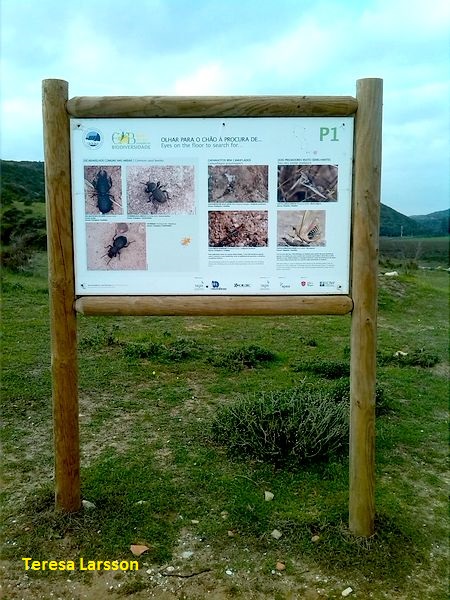
Look for insects on the soil…
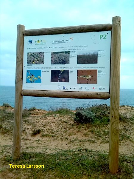
Look for the flowers…
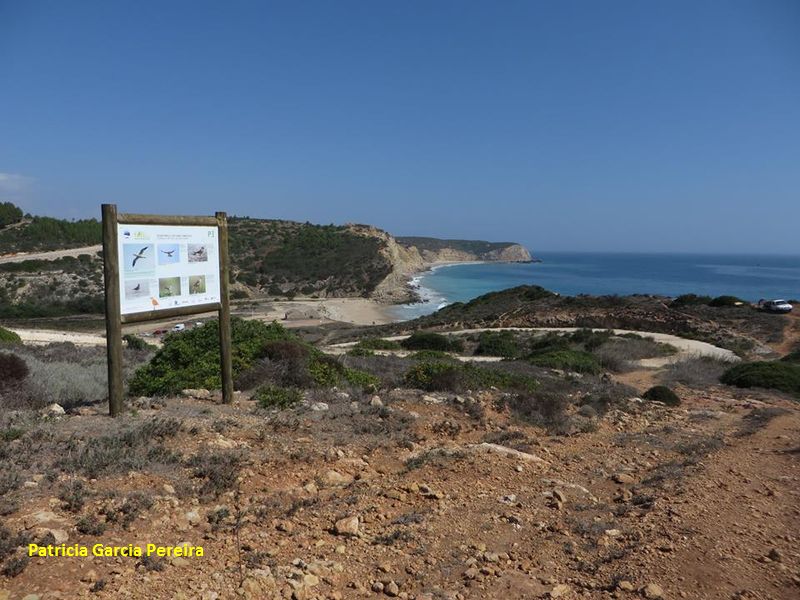
Look up to the sky and try to see the birds…
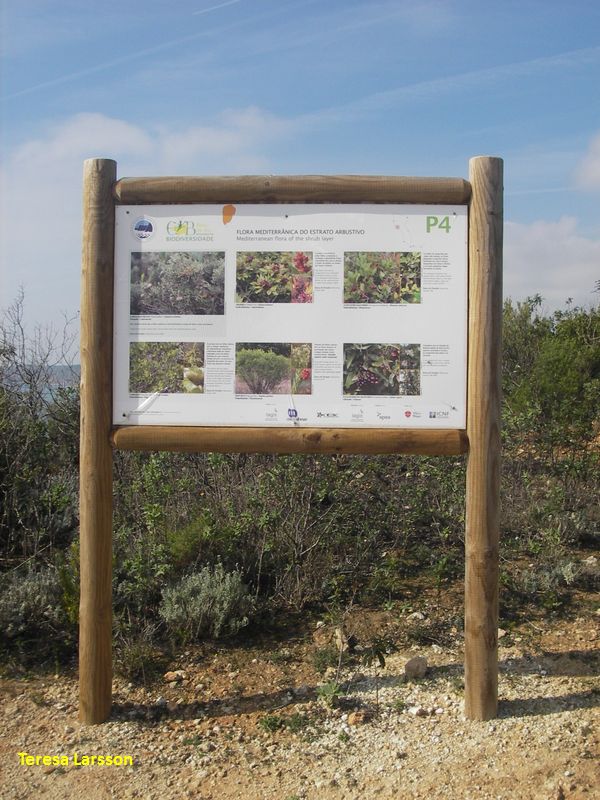
Know the shrubs of the Mediterranean vegetation...
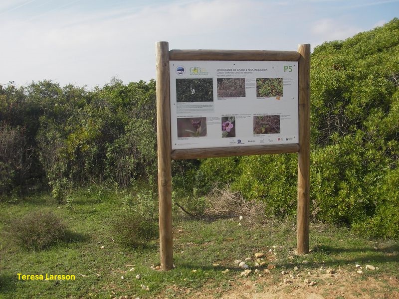
Know the genus Cistus plants (rockroses) and its inhabitants…
Look around and try to find small birds...
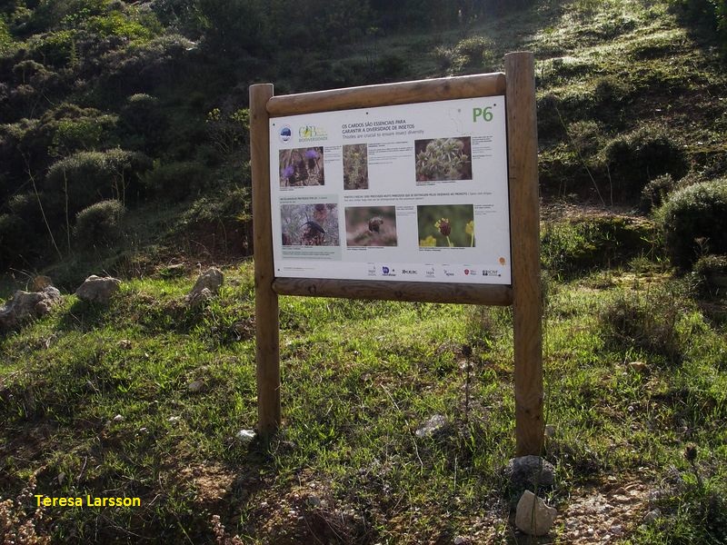
Know some thistles and its insects…
See the beauty even on common plants…
Help monitoring Boca do Rio’s butterflies…
Enjoy the view...

And, at the end, enjoy the beach!
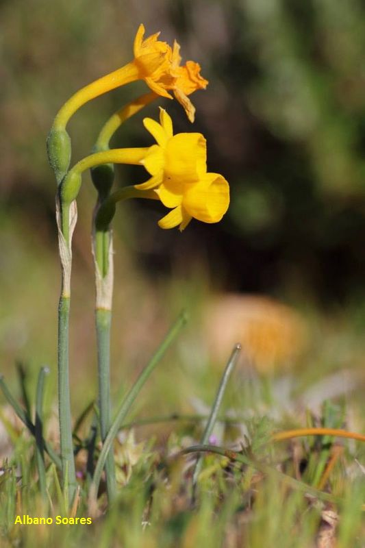
Narcissus gaditanus (endemic species in the Iberian Peninsula)
Estação da Biodiversidade da Boca do Rio
Share Image
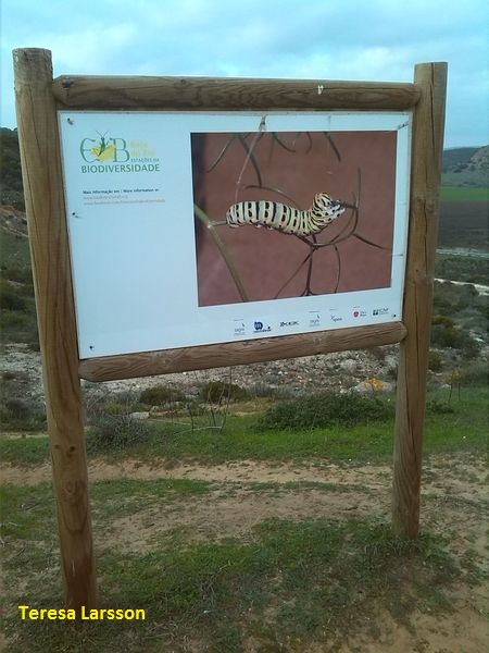
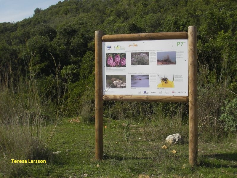
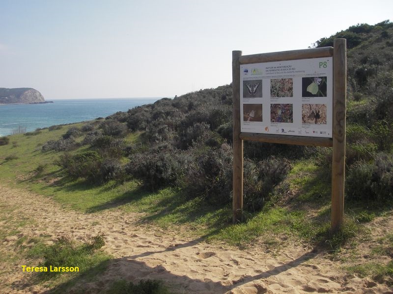
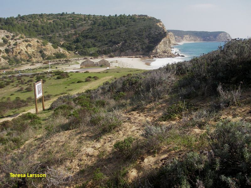
Estações da Biodiversidade (Biodiversity stations) are marked public trails, with information panels (also in English) on the biodiversity of those places. Each station is in an area of high specific and landscape richness, representative of the characteristic habitats of the area. This Station, with 8 points of interest (P), starts with the panel that gives you a warm welcome and explains what a Biodiversity Station is. Take the footpath and climb up to the cliff to the right before the beach. On the way up, look at the landscape and the Roman ruins. Read the panel relating various plants with insects that depend on them. "P2 - Plants and insects of the limestone cliffs of the Southwest." Look back and watch part of Budens marsh and the cliff ahead a little further back, catch a glimpse of the ruins of Fort S. Luís de Almádena. Continue walking northwest up to P3 dedicated to birds "P3 - Look at the sky, sea and shrubs." Try to find them. Go a little more to the northwest to P4 where you will find more information about plants and insects. Almost at the highest point of the route is"P5", observe the landscape and vegetation of the cliffs. Continue straight until you reach Rua (street) dos Pescadores. Turn right and then right again to enter a path not paved until you reach P6. Continue down with care, since the road is also used for automobiles. You get to the P7 with information about the Mediterranean scrubland on calcareous. Further down is P8 with more information about the flora and fauna. Enjoy the descent to the starting point and take a peek over Budens marsh.

-
Estações da Biodiversidade (Biodiversity stations) are marked public trails, with information panels (also in English) on the biodiversity of those places. Each station is in an area of high specific and landscape richness, representative of the characteristic habitats of the area. This Station, with 8 points of interest (P), starts with the panel that gives you a warm welcome and explains what a Biodiversity Station is. Take the footpath and climb up to the cliff to the right before the beach. On the way up, look at the landscape and the Roman ruins. Read the panel relating various plants with insects that depend on them. "P2 - Plants and insects of the limestone cliffs of the Southwest." Look back and watch part of Budens marsh and the cliff ahead a little further back, catch a glimpse of the ruins of Fort S. Luís de Almádena. Continue walking northwest up to P3 dedicated to birds "P3 - Look at the sky, sea and shrubs." Try to find them. Go a little more to the northwest to P4 where you will find more information about plants and insects. Almost at the highest point of the route is"P5", observe the landscape and vegetation of the cliffs. Continue straight until you reach Rua (street) dos Pescadores. Turn right and then right again to enter a path not paved until you reach P6. Continue down with care, since the road is also used for automobiles. You get to the P7 with information about the Mediterranean scrubland on calcareous. Further down is P8 with more information about the flora and fauna. Enjoy the descent to the starting point and take a peek over Budens marsh.
-
Algarve
-
Vila do Bispo
-
Sudoeste Alentejano e Costa Vicentina Nature Park
Base Characterization
-
PTCON0012 Costa Sudoeste (Southwest Coast)
PTZPE0015 Costa Sudoeste (Southwest Coast)
-
Museu Nac. de História Natural, Centro de Biologia Ambiental (Univ. de Lisboa) and Tagis.
Route Characterization
-
By car
Access to Boca do Rio from:
- Lisbon (320 km) - A2, A22, N125;
- Faro (90 km) - A22, N125.
After Lagos (N125) take Vila do Bispo direction. After Almádena cut to M537-2 (direction Burgau). In Burgau take Rua Agrícola (street), parallel to the coast. Pass Barrancão and later turn left to Boca do Rio.
GPS: 37.066314, -8.809845
Public transports
Plane: nearest airport is Faro International Airport (90 km).
Train: nearest train station - Lagos (CP).
Bus: Rede Nacional de Expressos (nearest bus station is in Lagos city) then take Eva Transportes (local bus, choose destination: Budens). In Budens, you can walk to Boca do Rio (3,5 km).
-
Yes
-
Near Boca do Rio beach.
-
Near Boca do Rio beach.
-
About 2 km.
-
All year long
-
1:30 h
-
67 meters
-
Easy
-
Ring road
-
Todos os grupos
Supports in place
-
Yes. Panels in Portuguese and English.
Topographic Profile
Bring water and binoculars, if you have it. After the trail go to the beach and, on the cliffs on the right (west), see the remains of a roman Villa.
By car
Access to Boca do Rio from:
- Lisbon (320 km) - A2, A22, N125;
- Faro (90 km) - A22, N125.
After Lagos (N125) take Vila do Bispo direction. After Almádena cut to M537-2 (direction Burgau). In Burgau take Rua Agrícola (street), parallel to the coast. Pass Barrancão and later turn left to Boca do Rio.
GPS: 37.066314, -8.809845
Public transports
Plane: nearest airport is Faro International Airport (90 km).
Train: nearest train station - Lagos (CP).
Bus: Rede Nacional de Expressos (nearest bus station is in Lagos city) then take Eva Transportes (local bus, choose destination: Budens). In Budens, you can walk to Boca do Rio (3,5 km).


