
Hiking - Walking
PR9 Between Escalda and Pulo do Lobo


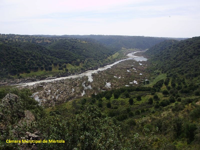
Guadiana valley before Pulo do Lobo waterfall
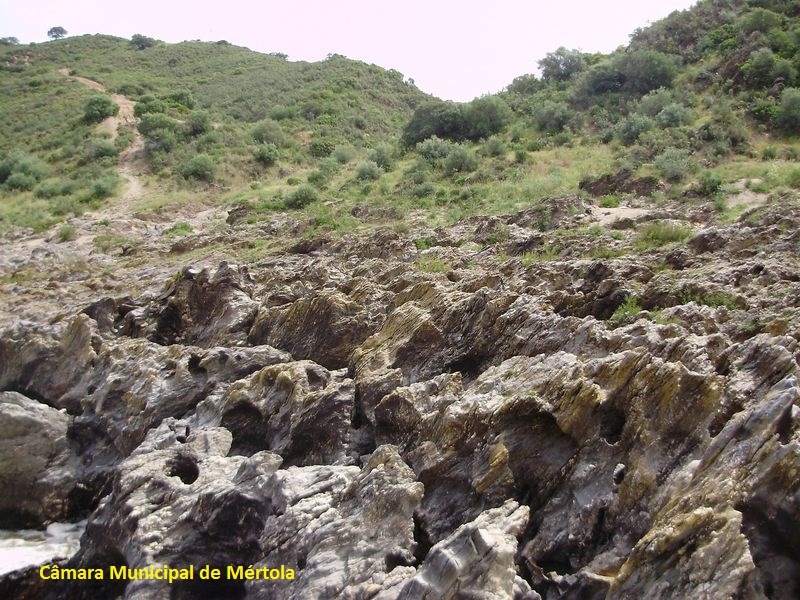
Kettle holes
Corredora area
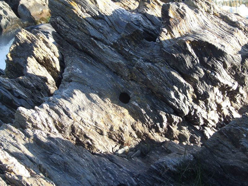
Sável hole
Pulo do Lobo area
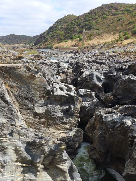
Pulo do Lobo waterfall

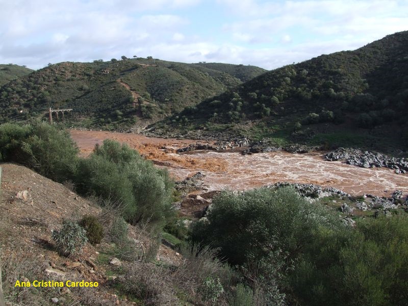
Pulo do Lobo submerged by a flood of Guadiana river
Pulo do Lobo

Pulo do Lobo area
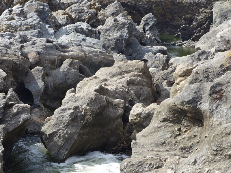
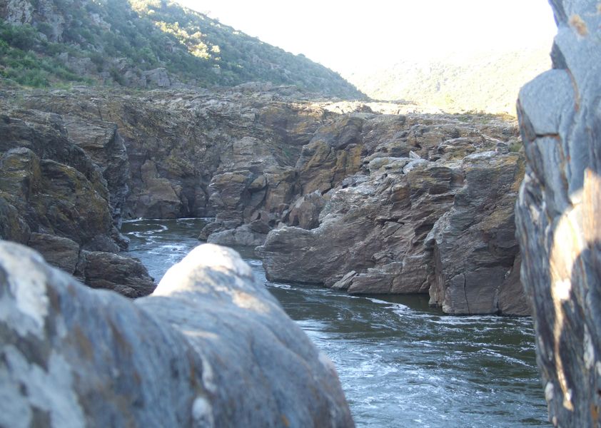
Guadiana between quartzite rocks
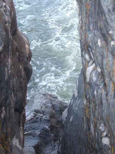
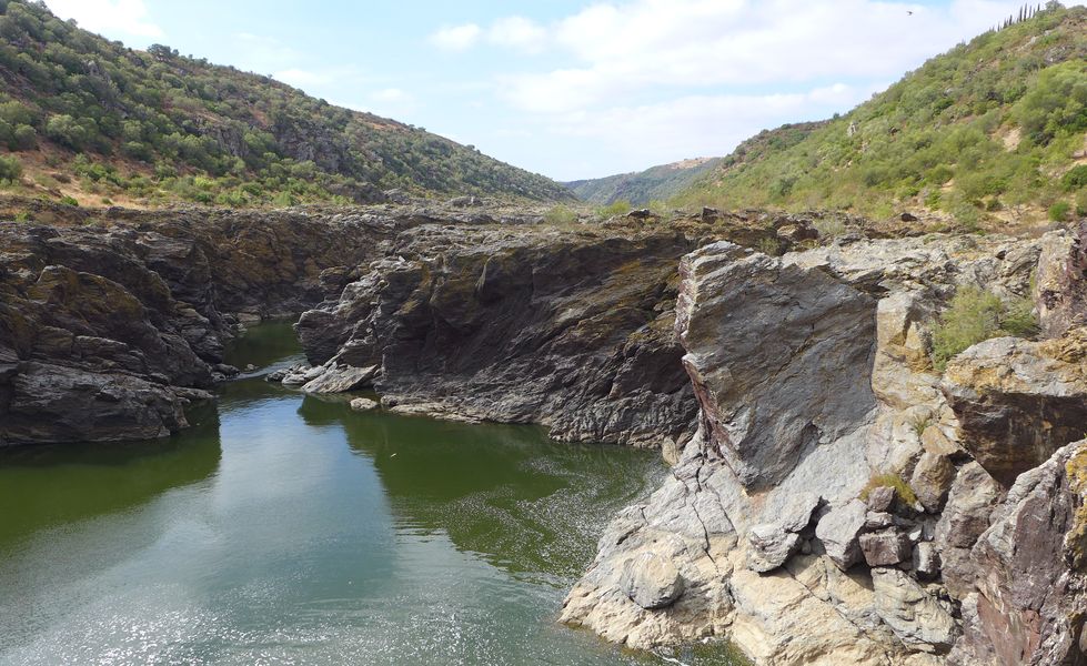
Rocks shaped by the Guadiana river!
PR9 Entre o Escalda e o Pulo do Lobo
Share Image
Trail for experient walkers. The beginning of this circular route is marked by the encounter with a landmark of the ancient history of this territory: the Pias dolmen. Back on the trail, the path leads to the river. Turning right, we head to the ruin of the old miller’s house at Escalda water mill, also known around here as “Pulo da Zorra” (fox leap). To the left is the road that leads to the mouth of the Terges e Cobres stream. On the way to Pulo do Lobo, the path becomes hard and the mill comes up amongst a dense vegetation of Cistus, Montpellier Cistus and Spurge Flax. The wild nature reigns and we can catch sight of the Black Stork or the Iberian Imperial Eagle. The path follows alongside the river and to the right we may see a still primitive luxurious vegetation. These are the remains of the holm oak woods. As we approach Pulo do Lobo (wolf leap), the ground becomes bumpier, which increases the challenge of the walk. As we arrive, the peacefulness and magnitude of such a unique place are a clear invitation to silence and contemplation. Pulo do Lobo is an ex-libris of the Nature Park of the Guadiana Valley. After a fall of about 16 metres over the Sável (Allis Shad) stream pool, the river flows toward the mouth. Here the river runs narrow between rocky walls, where the Black Stork, the Golden Eagle and the Eurasian Eagle-owl live and breed.

-
Trail for experient walkers. The beginning of this circular route is marked by the encounter with a landmark of the ancient history of this territory: the Pias dolmen. Back on the trail, the path leads to the river. Turning right, we head to the ruin of the old miller’s house at Escalda water mill, also known around here as “Pulo da Zorra” (fox leap). To the left is the road that leads to the mouth of the Terges e Cobres stream. On the way to Pulo do Lobo, the path becomes hard and the mill comes up amongst a dense vegetation of Cistus, Montpellier Cistus and Spurge Flax. The wild nature reigns and we can catch sight of the Black Stork or the Iberian Imperial Eagle. The path follows alongside the river and to the right we may see a still primitive luxurious vegetation. These are the remains of the holm oak woods. As we approach Pulo do Lobo (wolf leap), the ground becomes bumpier, which increases the challenge of the walk. As we arrive, the peacefulness and magnitude of such a unique place are a clear invitation to silence and contemplation. Pulo do Lobo is an ex-libris of the Nature Park of the Guadiana Valley. After a fall of about 16 metres over the Sável (Allis Shad) stream pool, the river flows toward the mouth. Here the river runs narrow between rocky walls, where the Black Stork, the Golden Eagle and the Eurasian Eagle-owl live and breed.
-
Alentejo
-
Mértola
-
Vale do Guadiana Nature Park
Base Characterization
-
PTCON0036 Guadiana
PTZPE0047 Vale do Guadiana (Guadiana Valley)
-
ICNF - Instituto da Conservação da Natureza e das Florestas, I.P.
Route Characterization
-
Access to Mértola from:
- Beja - IP2, IC27;
- Vila Real de Santo António - IC27;
- Castro Verde: N123, IC27.
Access to Beja from:
- Spain - EN260;
- Lisbon - IP8.
From Mértola, follow road N122 towards Beja. After 2 km, turn right at the crossroad indicating Corte Gafo de Cima. Arriving at this village, turn right at the crossroad towards Pulo do Lobo and Amendoeira da Serra. After 9 km, turn right at the crossroad towards Amendoeira da Serra. When inside this village, follow the signs indicating Pulo do Lobo to the place where the route begins, located about 5 km away from the village.
GPS: 37.814972, -7.649694
-
Yes
-
5.5 km
-
All year, but you should avoid Summer.
-
3 h
-
99 meters.
-
Hard
-
Ring road
Supports in place
-
Yes.
-
Explanatory panel. Amendoeira da Serra has accommodation and restaurants. Information available at CIPAS – Centro de Interpretação da Paisagem da Amendoeira da Serra (Landscape Interpretation Centre of Amendoeira da Serra).
Topographic Profile
This route is not recommended in wet weather. The ground is slippery and prone to flooding. Leaflet (in Portuguese) [PDF 1,6 MB]
Access to Mértola from:
- Beja - IP2, IC27;
- Vila Real de Santo António - IC27;
- Castro Verde: N123, IC27.
Access to Beja from:
- Spain - EN260;
- Lisbon - IP8.
From Mértola, follow road N122 towards Beja. After 2 km, turn right at the crossroad indicating Corte Gafo de Cima. Arriving at this village, turn right at the crossroad towards Pulo do Lobo and Amendoeira da Serra. After 9 km, turn right at the crossroad towards Amendoeira da Serra. When inside this village, follow the signs indicating Pulo do Lobo to the place where the route begins, located about 5 km away from the village.
GPS: 37.814972, -7.649694


