Geosite
Zêzere glacier valley

Zêzere glacier valley
Share Image
-
Zêzere glacier valley
-
Centro
-
Manteigas
-
Serra da Estrela Nature Park
Identification and Access
-
No
-
Access coming from:
- Manteigas - take direction to Torre, by N333.
Note: the valley is more beautiful when you come down from Torre to Manteigas.
GPS: 40.325000, -7.578333
Base Characterization
-
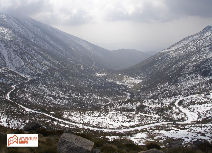
“Perfect example of glacier valley with U-shaped cross-section, glacier locks and sheepback rocks. The slopes show a coverage of slopes and post-glacial detrital cones. The valley is carved in the great fault from Bragança to Unhais da Serra that facilitated the fluvial and glacial erosion”. (in Geopark Estrela)
In Portugal, in Estrela mountain is where we can see the best forms and accumulations of rocky materials, due to ancient glaciers. The last glaciations that affected the Portuguese territory reached its maximum about 18,000 years ago and then the ice filled all of the valley of the river Zêzere upstream of Manteigas.
There you can find various types of stone accumulations called moraines, as well as traces of glacial erosion along the valley, and with the typical "U" shape of glacial valleys, with a straight path of 8 km. During the maximum of glaciation, it have had a length of about 13 km, reaching a thickness of 300 m.
Cirque glacier - amphitheatre-shaped basin with steep walls, formed on a mountainside by glacial erosion.
Moraine – rock accumulation deposited primarily by the direct action of a glacier.
Sheepback rock, glaciated knob or mammillated rock - rounded, glacially eroded rock outcrop, usually one of a group, resembling a sheep's back.
-
International