
Geosite
Fault of Vilariça-Manteigas

Fault of Vilariça-Manteigas
Share Image
-
Fault of Vilariça-Manteigas
-
Centro
-
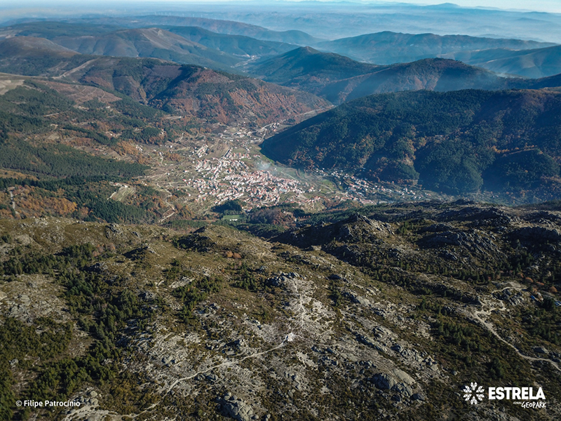
Manteigas
-
Serra da Estrela Nature Park
Identification and Access
-
No
-
Access from:
- Manteigas (± 15 km) – N338 and N339, km 34;
- Seia (± 39 km) – N339.
GPS: 40.311912, -7.583410
Base Characterization
-
In this site of ancient gravel extraction, the fault is revealed by a much altered granite forming a material of sandy aspect, commonly known as gravel. Sometimes it is mixed with ferruginous and loamy zones of yellowish color. Observing the landscape on Pedrice slope, you can see the presence of an alignment of these altered zones, that corresponds also to the Zêzere and the Alforfa valleys, in the N20E direction, evidencing a major regional fault. In fact, it extends for about 250 km, from Puebla de Sanabria (Spain) through Bragança, Vilariça, Vila Nova de Foz Côa, Manteigas, Unhais da Serra to Sertã.
It is an active fault that was formed about 300 million years ago, responsible for several thermal springs and seismic activity.
In Vilariça, in the geological past, displacements of about 8 km were estimated.
-
Unkown


