
Geosite
Loriga glacier valley

Loriga glacier valley
Share Image
-
Loriga glacier valley
-
Centro
-
Seia
-
Serra da Estrela Nature Park
Identification and Access
-
No
-
Access coming from:
- Seia (± 24 km) - N339.
- Torre (± 2 km) - N339.
The valley and the glacial cirques are on the right if you are going to the top of Estrela mountain on N339 coming from Seia. You can see the valley quite well from the ski resort.
GPS: 40.333298, -7.641193
Base Characterization
-
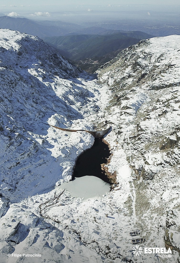
In the western sector of Estrela Mountain, in the parish of Loriga and witnessing the existence of glaciers, there are these glacier circuses, in staircase, belonging to the glacial language of Loriga. See the succession of filled lakes and coves (the so-called Covões de Loriga: Boeiro, Meio, Nave, and Areia), the sheepback rocks and marks of glacial erosion proving the past existence of a glacial valley with great slope. There is also a set of well-developed frontal moraines, proof of the maximum extent of the glacier that occupied this valley. Loriga village is at the end of the valley.
Note the succession of lakes and coves that attest steep glacial valley and see Loriga at the end.
Glacier circus – on the upper zone of a glacier is a sunken (depression) zone with abrupt walls, due to the accumulation of snow that feeds the glacier.
Moraine – rock accumulation deposited primarily by the direct action of a glacier.
Sheepback rock, glaciated knob or mammillated rock - rounded, glacially eroded rock outcrop, usually one of a group, resembling a sheep's back.
-
National


